Returning to my room at the Silver King Inn & Suites, I showered and cleaned up my hiking clothes and boots and gear and then headed to downtown Leadville. Now I could relax, explore the town, then later have a beer and dinner (which I did, at Quincy's Tavern).
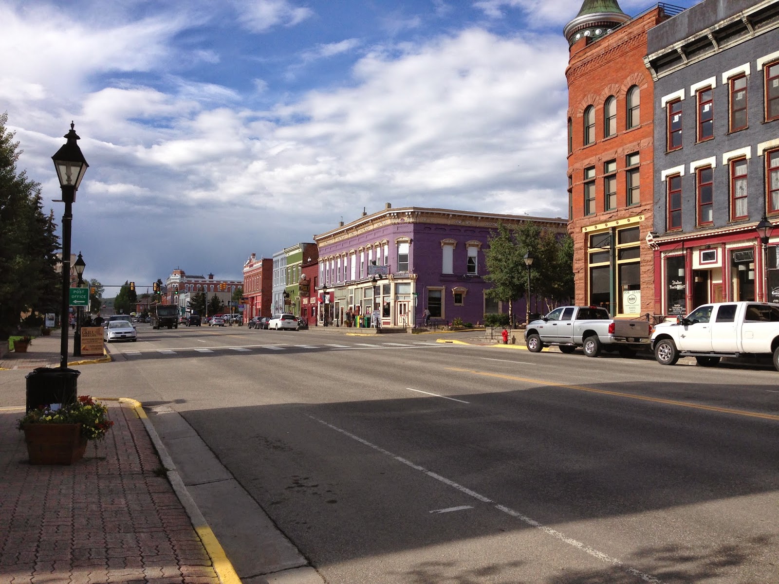 Strolling through town was fun. By the looks of things, I'm sure this historic town hadn't changed much over the years, except maybe for paved streets and electric traffic lights.
I thought about my grandparents who spent some time here during their early marriage years (circa 1916) while they lived in Denver. What did they do here?
 |
| Tabor Opera House |
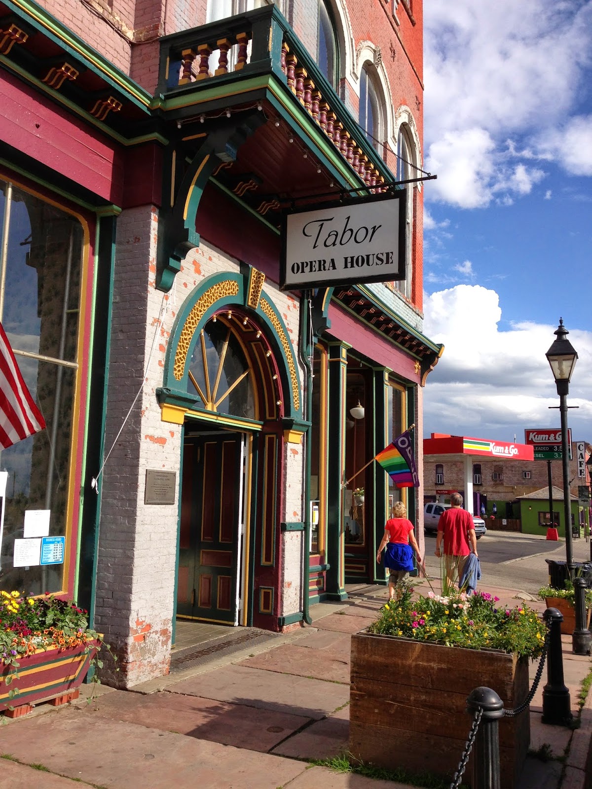 Leadville sits at 10,152 feet. It is still the highest incorporated city in North America. It has a history rich in the mining of gold, silver, lead, zinc and copper. It also has a festive past and still sports the Tabor Grand Hotel and Opera House. The world-famous magician Harry Houdini, John Philip Sousa, the British
wit Oscar Wilde, the great actress Sarah Bernhardt and many wonderful
operatic performers "trod the boards" of The Tabor during its heyday.
Leadville sits at 10,152 feet. It is still the highest incorporated city in North America. It has a history rich in the mining of gold, silver, lead, zinc and copper. It also has a festive past and still sports the Tabor Grand Hotel and Opera House. The world-famous magician Harry Houdini, John Philip Sousa, the British
wit Oscar Wilde, the great actress Sarah Bernhardt and many wonderful
operatic performers "trod the boards" of The Tabor during its heyday. |
| Doc Holliday |
Also around 1883, outlaw Doc Holliday moved to Leadville, shortly after the gun fight at the O.K. Corral. On August 19, 1884, Holliday shot ex-Leadville policeman, Billy Allen, after Allen threatened Holliday for failing to pay a $5 debt. Despite overwhelming evidence implicating him, a jury found Holliday not guilty of the shooting or attempted murder.
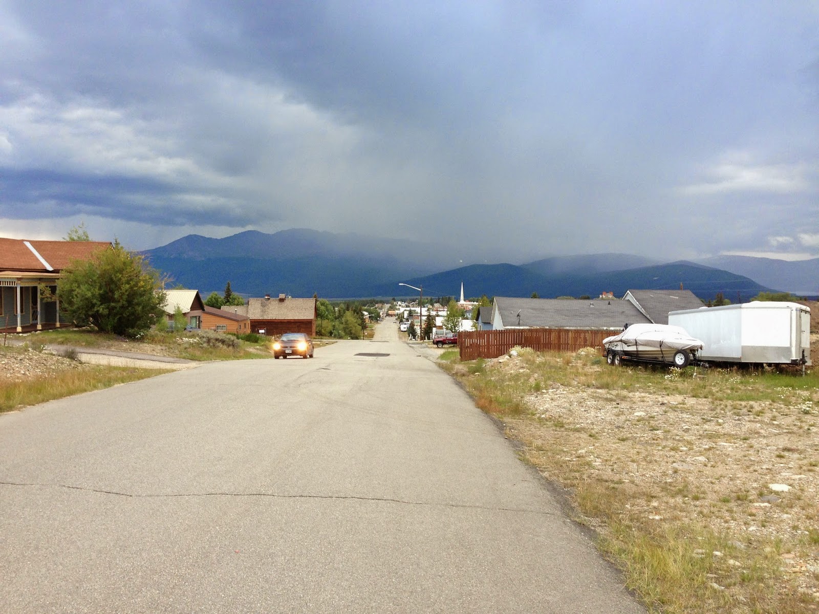 As I soaked up the sun in the historic mountain town, I watched the thunderclouds gathering above the mountains lying just outside of town. Definitely raining on the summits now! This was August 30 (2013) and the sun was hot, hot, hot, but the air was
cool. When I walked up one side of the street in the sun, I was
sweating and could feel the sun's rays burning my skin. But when I
crossed to the other side in the shade, I felt like I should pull on a
fleece. Such is Colorado's summertime.
As I soaked up the sun in the historic mountain town, I watched the thunderclouds gathering above the mountains lying just outside of town. Definitely raining on the summits now! This was August 30 (2013) and the sun was hot, hot, hot, but the air was
cool. When I walked up one side of the street in the sun, I was
sweating and could feel the sun's rays burning my skin. But when I
crossed to the other side in the shade, I felt like I should pull on a
fleece. Such is Colorado's summertime.The next morning I reluctantly bade goodbye to Leadville to head to New Mexico. The drive was gorgeous heading south along US Highway 24. I was passing Mt. Massive, Elbert, Mt. Hope, Emerald Peak, and then came the collegiate mountains. Oxford, Harvard, Yale, and others. I stopped and took a photo of Mt. Yale and sent it by text to my niece Susanna who had just been awarded her doctoral degree there. Isn't it impressive? Yes, both niece and mountain! She texted back and said she didn't know there were collegiate mountains but agreed it was beautiful.
 |
| Mt. Yale |
Finally I crossed into New Mexico. The mountains stopped looking beautiful. The landscape grew more dry and barren looking. The highway was straight and flat. Little pueblo homes half buried in the earth started appearing here and there. Who would live here, I thought? I know people love the southwest, but I have never been a fan. My destination was Taos. As I approached, I scanned the horizon to see if I could see the high point.
As a high pointer, I always do that, and I wonder if others do. When I arrive in the general vicinity of my high point, I start looking for it, no matter it's elevation! It is usually visible, unless it's buried behind other mountains.
When I arrived in downtown Taos, there was a huge traffic jam, and the cars crawled along. It was hot. The sidewalks were teeming with tourists. American Indian motives fought and rubbed with Spanish decor. It took forever to go a few miles. I checked into my inn and decided an afternoon spent by the pool sounded restful and inviting.

Then suddenly, as your mind has a way of eventually accepting the inevitable, no matter how dismaying, my thoughts turned around. I shouldn't be sitting here cursing the mountains, was I completely mad? I should be appeasing the gods of the mountain, offering sacrifices to the Blood of Christ, asking for blessings for me and for the surrounding area, offering gifts, burning incense and preparing prayer flags.
The next morning I checked out before dawn and drove up the road to Taos Ski Valley in darkness (missing the inn's free breakfast once again). I was entering the Carson National Forest. After the entrance to the Ski Resort, the car climbed another 1,000 feet up to the Bavarian Restaurant and Phoenix Grill behind which was the trail head. I was rummaging in my car doing last minute preparations very quietly because I could see there were tent campers scattered around. When at last I found what I was looking for (which was, in fact, already in my pack), I discovered I could abandon my flash light because of the pre-dawn light. I stole quietly over the grounds, hiking under the base of the Kachina ski lift, as per my directions. Here and there were tents and then I passed a campfire with people still quietly talking and singing to a ukulele. These people hadn't been to bed yet! They were still partying!


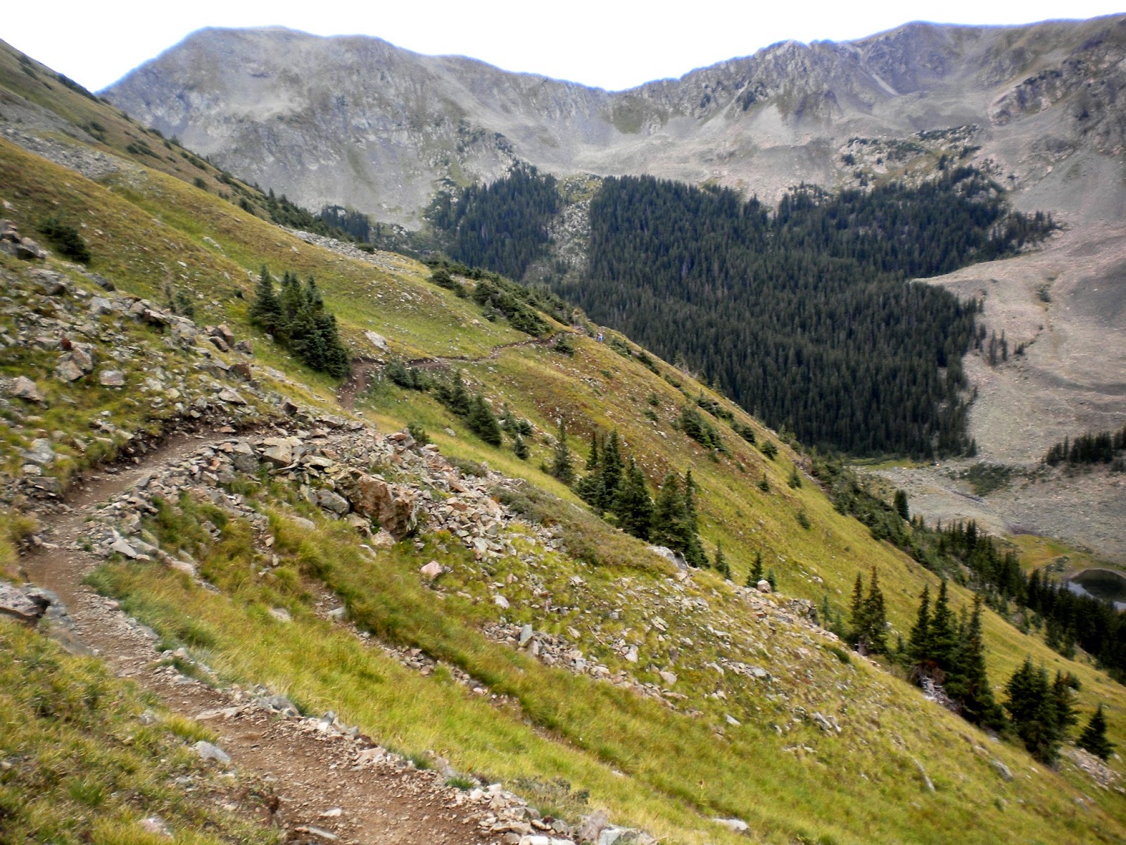
The trail was broad, rocky, and well worn, and it ascended gradually 2 miles toward Williams Lake. It crosses avalanche trails and you can see where large swaths of pines were flattened.
Shortly before the lake was an intersecting trail for Wheeler summit.
 |
| Just above treeline |
 |
| Looking back down the trail |
There was no messing around now. My route description said, "the trail rapidly climbs through a series of switchbacks" and hikers' comments include, "a quick way to get off the mountain, but a bitch to get up." Another referred to "those nasty switchbacks."
As I hiked ever higher, I would look up at the ridge and think, "I only need to gain the ridge, I only need to gain the ridge." But somehow that ridge never looked any closer. The narrow path was steep, altitude air was thin, and I was stopping to breathe at the end of every switch back. Again.
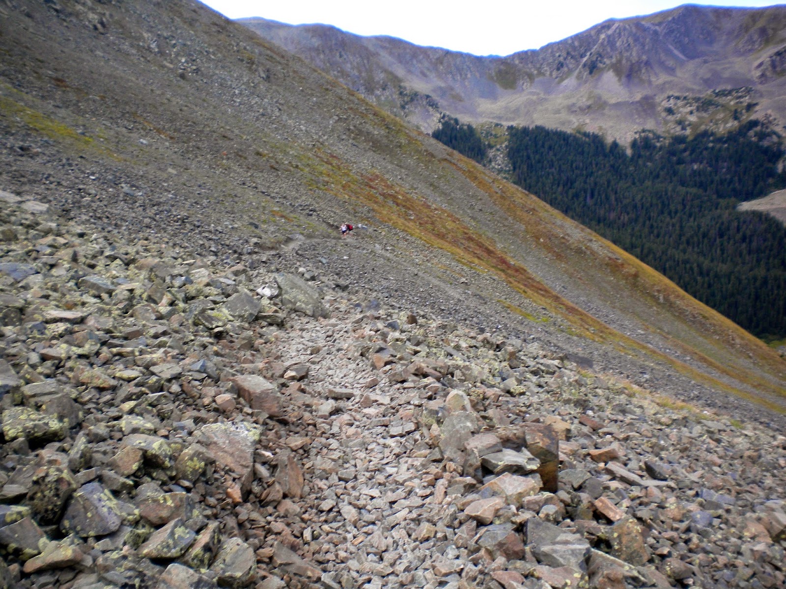 Sometimes the trail would cross these scree fields and then managing your footing got a little slippery, being on gravel-sized rocks and on a steep pitch as well.
I spotted two hikers coming up behind me quite a ways down. I thought they would pass me up shortly, just like on Elbert, but then they didn't seem to get any closer.
So, I just kept at it, back and forth across the mountain slowly gaining the seemingly elusive ridge that I could see but couldn't quite reach. Then finally, FINALLY, I saw the cairn that marked the ridge top and heaved myself up and over the last steep part!

Hallelujah! And it wasn't raining! The gods were smiling on me. Good thing I had that change of heart the day before.

To my left the ridge trail mosied over to Mount Walter. While I was all the way up here, I wondered if I should hike on over and summit it too? I wondered for about a second and then thought, "Heck no!"
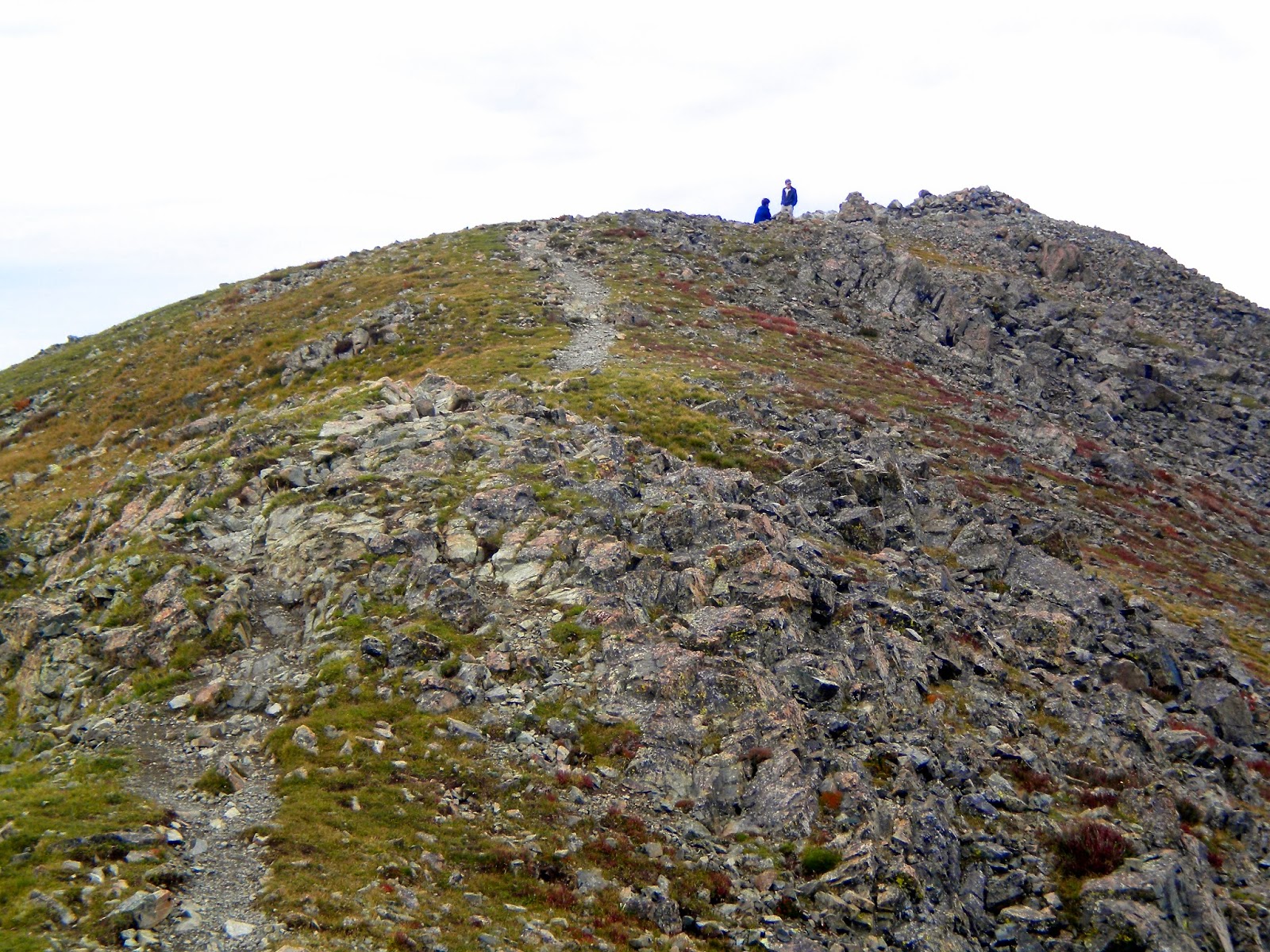
Instead I turned right where the trail meandered over a few false summits and then on to the actual summit of Wheeler Peak.

A couple of campers who beat me to the top that day took my picture and we were shortly joined by the 2 young men behind me. Here we are looking DOWN at Taos Ski Valley. I remember skiing there one winter. I didn't have fun then, either. And they didn't allow snow boarding.

The way down, as always, was easy with a panoramic view spread out before me.
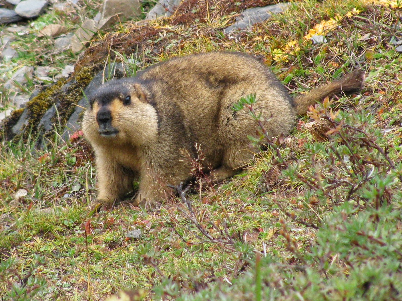
See the scrubby plants covering the steep mountainside? Well every so often a marmot would wait until I was practically upon it, and then suddenly explode up through the shrubbery and run away, scaring the daylights out of me.

As I strode up to the parking lot, I could see now in the light of day that there was some kind of music festival going on at the Bavarian. There was a stage where some young men were performing sound checks. And a few early risers from the many tents scattered around, were up and about (it was about 11 am). But most were still asleep! The sun was high and hot and I thought it must be starting to get hot inside those tents. It was hot outside the tents!!
